
Global Navigation Satellite System (GNSS) technology has become an important part of modern positioning applications. It is used in agriculture, surveying, transportation, and machine control. However, standard GNSS positioning may have errors caused by signal delays, satellite conditions, and environmental factors.
To improve positioning accuracy, RTK technology uses correction data to reduce these errors and provide more precise location information. Understanding how RTK works helps users see why it is valuable for precision-based operations and how it supports applications that require more reliable positioning results.
How RTK Improves the Accuracy of GNSS Positioning
RTK, or Real-Time Kinematic technology, is a positioning method that improves GNSS accuracy through real-time correction signals. A base station with a known position collects satellite data and sends correction information to a rover device. The rover then uses this information to calculate a more accurate position compared with traditional GNSS methods.
The core idea of RTK is reducing positioning errors between the base station and the moving receiver. Factors such as atmospheric conditions and satellite orbit changes can affect GNSS signals. By comparing data from both locations, the system can adjust the positioning results and provide more detailed location information.
For applications that require accurate movement paths, an RTK GNSS receiver can support stable positioning by receiving satellite signals and correction data together. This type of equipment is commonly used in agricultural machinery because accurate navigation helps machines follow planned routes during field operations.
Understanding the Components Behind RTK Systems
An RTK system usually includes several important components, including GNSS antennas, receivers, correction communication links, and software. The base station provides correction data, while the rover receiver processes satellite information and applies the corrections during operation.
The quality of positioning depends on different factors, such as satellite visibility, correction signal availability, and installation conditions. Open environments usually provide better satellite communication because fewer obstacles block signals. Proper equipment setup is also important for maintaining consistent positioning performance.
In agricultural applications, RTK systems are often combined with tractor guidance solutions. Farmers can use accurate positioning data for activities such as planting, spraying, and field management. This helps reduce unnecessary overlaps and supports more organized farming processes.
The Role of an RTK GNSS Receiver in Precision Agriculture
Precision agriculture relies on accurate location information to improve how farming equipment operates. Traditional manual driving methods may create small positioning differences between working paths. Over large fields, these differences can affect operation planning and resource management.
An RTK GNSS receiver helps agricultural machines obtain more accurate positioning information by combining GNSS signals with correction services. With this technology, machines can maintain planned routes more consistently during field tasks. This is especially useful for operations that require repeated passes across farmland.
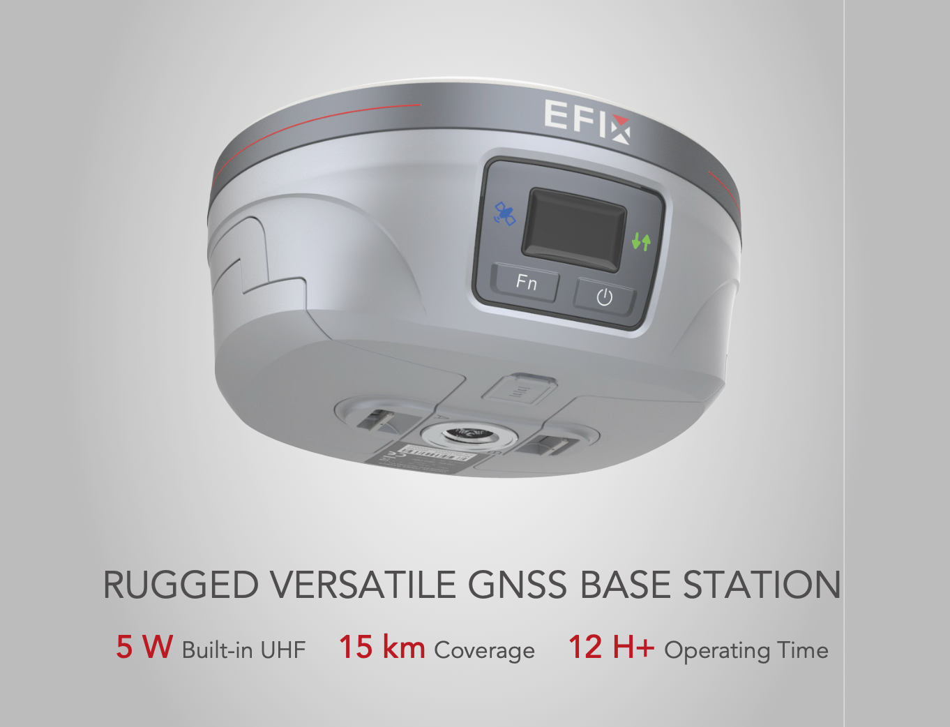
As a company focused on agricultural positioning solutions, EFIX develops GNSS-based products designed for smart farming applications. Their eBase product is a GNSS reference station that provides correction data for RTK positioning. It can work as part of an RTK solution to support agricultural equipment that requires accurate location information.
The eBase system is designed to provide correction services for farming environments. It supports communication with compatible GNSS equipment and helps create a foundation for accurate agricultural navigation. By combining reference station technology with other positioning devices, farmers and equipment operators can build suitable precision farming systems.
Practical Applications of RTK Technology in Farming
RTK technology has several practical uses in modern agriculture. One common application is automatic steering for tractors and other agricultural machines. Accurate positioning allows machines to follow specific routes without depending only on manual control.
Another application is field mapping and management. Farmers can collect location-based information during agricultural activities and use it for future planning. This information can support decisions about planting areas, machine operation, and field organization.
RTK also supports more efficient use of agricultural resources. When machinery follows accurate paths, operators can better manage working areas and reduce repeated operations. However, actual results depend on factors such as equipment configuration, field conditions, and operating methods.
EFIX provides positioning products that are related to these agricultural technology needs. Their solutions focus on GNSS positioning and smart farming applications, helping users connect positioning technology with agricultural machinery requirements.
Why RTK Technology Matters for Future GNSS Applications
GNSS technology continues to develop as industries require more accurate positioning solutions. RTK improves traditional GNSS performance by adding correction information, making it suitable for tasks where small positioning errors can affect results.
For agriculture, accurate positioning is becoming an important part of equipment automation and digital management. Farmers and agricultural equipment manufacturers need reliable positioning systems to support smarter workflows.
An RTK GNSS receiver is one of the key devices that connects satellite positioning technology with practical applications. When combined with suitable correction sources and system design, it can support accurate navigation for agricultural equipment.
Conclusion
RTK technology improves GNSS positioning by correcting signal errors and providing more detailed location information. Its working principle combines satellite data, reference stations, and correction communication to achieve higher accuracy.
From automatic steering to field management, RTK has expanded the possibilities of precision agriculture. Companies such as EFIX continue to develop GNSS-related solutions, including products like eBase, to support agricultural positioning requirements. As farming becomes more connected with digital technology, accurate positioning will remain an important part of modern agricultural operations.